At Vinci Surveys, we provide a full range of professional land and building surveying services designed to support construction, planning, and development projects across the UK. Whether you’re an architect, developer, engineer or private client, our experienced team delivers precise, reliable data to help you make confident decisions at every stage.
From measured building surveys to drone mapping, each service is tailored to meet the specific needs of your site and your goals.
Our investment in the latest technology (such as 3D laser scanning and high-accuracy GPS) means faster turnaround, exceptional accuracy, and clear deliverables you can trust. Below, you’ll find a summary of our key services, each linking to a dedicated page with more detail about how we work and what you can expect.
1. Land Surveying
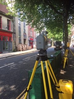
A precision-driven service, Land Surveying establishes accurate control networks essential for any development or boundary-related project. Vinci Surveys uses advanced survey equipment to check as‑built conditions, map property extents, and ensure your site aligns precisely with legal and design documents
This service supports architects, builders, developers, and landowners needing reliable coordinates, topography, and boundary clarity. Whether confirming existing infrastructure or planning a new build, a detailed land survey ensures compliance and reduces risks from surveying errors.
2. 3D Laser Scanning
Vinci Surveys’ 3D Laser Scanning captures vast amounts of spatial data in the form of dense point clouds—ideal for complex or heritage structures requiring meticulous detail. It’s especially useful in hazardous or hard-to-access areas where traditional methods would be slow or impractical
Clients benefit from precise 3D models used for renovation planning, conservation efforts, and integration into BIM/CAD environments. This method reduces on-site time and creates a lasting digital asset for future reference, analysis, or restoration scenarios.
3. Topographical Surveys
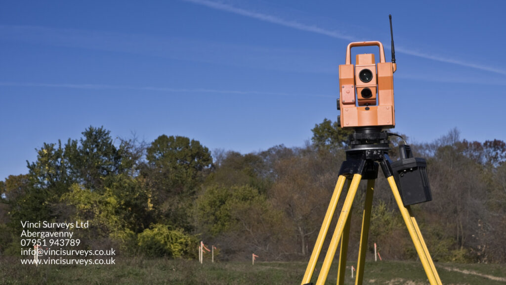
Topographical surveys generate accurate terrain models, mapping contours, site features, and elevations across your project area. Vinci Surveys uses total stations, GPS receivers, and theodolites to ensure high-resolution coverage, critical for design and construction planning.
By including boundary outlines, natural features, and built structures, these surveys help clients visualise site conditions and support planning, drainage, infrastructure layout, and landscape architecture. A reliable topo survey lays the groundwork for every successful project.
Call us today
4. GPS Surveys
State‑of‑the‑art GPS surveying delivers fast and accurate coordinates tied to Ordnance Survey grids. Vinci Surveys utilises static, RTK, and CORS techniques to deliver sub‑centimetre accuracy under typical site conditions
Ideal for establishing control points, monitoring movement, and integrations with other survey types, GPS surveys reduce setup time and improve reliability, especially across large sites. This service enhances confidence in every subsequent surveying task.
5. Setting Out & Levelling
Setting Out and Levelling services support precision in translating design into physical construction. Vinci’s team handles layout tasks alongside architects, engineers, and project teams to ensure structure alignment with engineered drawings.
This service includes horizontal and vertical control essential for foundations, utilities, heights, and alignments. Accurate setting out cuts rework and delays, saving time and cost across the build.
6. Measured Building Survey
Measured Building Surveys produce detailed floor plans, elevations, and sections of existing structures. Vinci Surveys creates fully scaled records ideal for remodels, extensions, or regulatory documentation.
This is essential when precise knowledge of interior layouts, external facades, and structural dimensions is needed for planning, design, or conservation work. A measured survey brings clarity and accuracy to every redevelopment or refurbishment.
Call us today
By combining professional surveying expertise with expert drone piloting, Vinci offers fast, safe, and cost-effective aerial data collection. Drones can access challenging or risky areas without endangering staff.
Ideal for large-scale site mapping, topographical overviews, progress tracking, and inspections, drone surveys enrich projects with high-resolution imagery and point cloud data. This method enhances safety, efficiency, and value for money, without compromising on precision.
Whatever the size or scope of your project, Vinci Surveys is here to provide expert guidance and data you can build on. Every service we offer is backed by technical knowledge, professional integrity, and a commitment to helping your project run smoothly from start to finish. Explore our full service range or get in touch to discuss your requirements. We’re always happy to offer advice or provide a free, no-obligation quote.